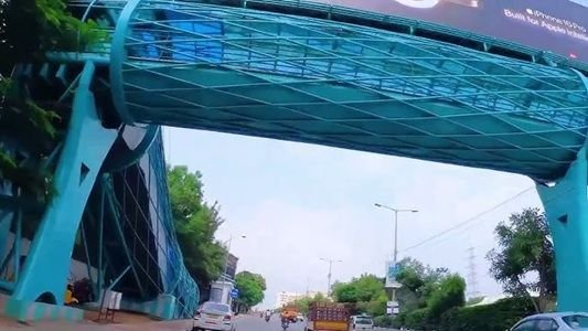
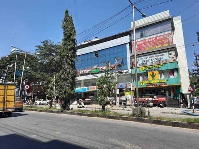
A rail line converting from meter-gauge to broad-gauge, a highway that stretches from Agra to Mumbai, and a suburb steadily merging into greater Indore — Rau Circle sits at the intersection of all three. This is the primary navigation landmark for Rau town, positioned directly on NH-52 between Mhow and Rajendra Nagar, and it’s grown into something more than a simple crossroads as Indore’s metropolitan footprint has expanded outward.
For anyone travelling the Agra-Bombay Road corridor through southwestern Indore, Rau Circle is impossible to miss.

Rau Circle Overview
| Detail | Information |
| Location | AB Road (NH-52), Rau, Indore District |
| PIN Code | 453331 |
| Distance from Indore City Centre | ~11 km southwest |
| Highway | NH-52 (Agra-Bombay Road, formerly NH-3) |
| Railway Station | Rau (station code RAU) |
| Bus Service | AiCTSL city buses, every 15 minutes; also a FlixBus boarding point |
| Metro Status | Proposed corridor along AB Road; not yet operational |
Rau’s Position Within Greater Indore
Rau functions as a suburb and nagar panchayat within the Indore Metropolitan Region, sitting on NH-52 between Mhow to the south and the Rajendra Nagar area of Indore to the north. The road connecting Pithampur — Indore’s major industrial zone — to central Indore also branches out from Rau, giving the town an outsized transport role relative to its size. Rau sits at roughly 530 metres above sea level, with a subtropical climate typical of the region.
Why Rau Circle Matters as a Navigation Point
Rau Circle serves as the town’s primary landmark, and its role extends beyond local traffic — it’s also a designated FlixBus boarding and dropping point for intercity AC bus services, connecting Rau into a broader interstate travel network.
Getting to Rau Circle
Multiple routes converge on the circle from different parts of Indore and beyond:
- Via AB Road from central Indore: Through Rajendra Nagar and the Indore-Rau corridor, roughly 14 km, 20-30 minutes by road or AiCTSL bus
- From the airport via Airport Road: Joining AB Road southwestward past Rajendra Nagar, about 16 km, 20-30 minutes
- From Chameli Devi School/Sarwate area: A direct AiCTSL bus journey to Rau Bus Stand, taking about 19 minutes
- Via CAT Road (Pithampur Road): Approximately 15 km, 20-30 minutes, useful for anyone connecting from the Pithampur industrial belt
Rail Access: A Station Growing Into a Junction
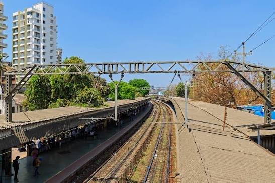
Rau Railway Station sits on the line from Ratlam to Akola, now converted from meter-gauge to broad-gauge and electrified since 2017. A few practical details:
- Nearest broad-gauge main station — Indore Junction, about 18 km away
- Mhow (Dr. Ambedkar Nagar) Station — roughly 13 km south
- Future development — Rau is expected to become an official railway junction once the Indore-Dahod and Indore-Chota Udepur lines become fully operational, adding significant future rail relevance to the town
Bus Connectivity
AiCTSL city buses give Rau Circle reliable, frequent access to central Indore:
- Service frequency — every 15 minutes throughout the day between Rau and Indore city
- Journey time — around 19 minutes from Rau Bus Stand to central Indore stops like Chameli Devi School and Sarwate
- This is currently the primary rapid public transit option, given the absence of an operational metro
Metro: What’s Being Planned
Indore doesn’t yet have an operational metro system, but the city’s proposed metro corridors include an alignment along the AB Road corridor — the very stretch that passes through Rau. If sanctioned and completed, this would bring metro access directly to the Rau Circle zone, significantly upgrading connectivity between Rau and central Indore. Until then, residents rely on AiCTSL buses and personal vehicles.
What’s Around Rau Circle
- Rangwasa — a nearby village on Rau Navda Road, home to the Raja Ramanna Centre for Advanced Technology (CAT)
- Medi-Caps Institute of Technology and Management — an educational institution close to the circle
- Medicaps IT Park (SEZ) — a nearby special economic zone
- Rajendra Nagar — one of Indore’s greener, semi-established residential localities, bordering Rau to the north
FAQs
Q1. Does Rau have metro access currently?
Not yet — Indore’s metro system isn’t operational as of this writing, though the AB Road corridor through Rau is part of a proposed metro alignment. Until that’s built, AiCTSL buses remain the primary rapid transit option.
Q2. How often do buses run between Rau Circle and central Indore?
AiCTSL city buses depart approximately every 15 minutes throughout the day, with the journey to central Indore stops taking around 19 minutes — a genuinely reliable schedule for daily commuters.
Q3. Is Rau a good location for rail travel, given the station’s current status?
It’s improving — Rau Railway Station is fully operational on the broad-gauge Ratlam-Akola line, and is expected to become an official junction once the Indore-Dahod and Indore-Chota Udepur lines are completed, which would add meaningful long-term rail value.
Q4. Why does Rau Circle matter for anyone travelling to Pithampur?
The road connecting Pithampur, Indore’s major industrial area, to central Indore branches directly from Rau, making Rau Circle a practical reference point for anyone commuting to or from that industrial corridor.