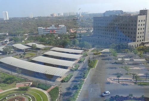
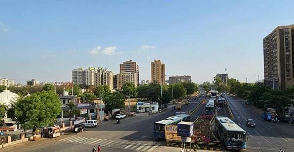
Call it a circle, and you’re actually talking about a cluster. Sarkhej isn’t one single roundabout — it’s a tight grouping of closely adjacent junctions, all sitting within 500 to 800 metres of each other, where the Sarkhej-Gandhinagar Highway, Sarkhej-Bavla Road, and Sarkhej-Sanand Road all converge. Locals navigate this stretch by landmark as much as by circle name, and the Ujala Hotel — lending its name to the popular Ujala Circle — is one of the most commonly used reference points in the entire zone.
For anyone unfamiliar with the area, that multi-node structure is worth understanding before you go looking for “Sarkhej Circle” on a map.

Sarkhej Circle Overview
| Detail | Information |
| Location | Sarkhej-Makarba-Vejalpur zone, southwestern Ahmedabad |
| Key Roads | Sarkhej-Gandhinagar Highway (SG Highway), Sarkhej-Bavla Road, Sarkhej-Sanand Road |
| Nearest Ring Road | SP Ring Road, ~5 km |
| Railway Access | Dedicated Sarkhej station, Ahmedabad Suburban Railway |
| Metro Status | No direct metro connectivity currently |
| Nearby Employment Hubs | Prahlad Nagar and Satellite (6-8 km away) |
Understanding the Sarkhej Junction Cluster
What most people call “Sarkhej Circle” is technically three closely spaced junctions functioning as one transit zone:
- Sarkhej-Gandhinagar Highway Circle — also referred to as Sanand Circle, marking the SG Highway intersection
- Ujala Circle — the Sarkhej-Bavla junction, named after the adjacent Ujala Hotel
- Sarkhej-Sanand Cross Road — the third node in this cluster, handling traffic toward Sanand
Understanding this structure matters practically — if someone gives you “Sarkhej Circle” as a destination, it’s worth confirming which of the three nodes they actually mean, since they can be several minutes apart by road despite sitting so close together.
Why This Zone Anchors Southwestern Ahmedabad
Sarkhej sits at the city’s western edge, and its road network gives it genuinely strong reach — both into central Ahmedabad and outward toward Saurashtra. The SG Highway runs directly through the locality, SP Ring Road sits just 5 km away, and the Sarkhej-Bavla and Sanand-Sarkhej roads add further regional connectivity. This combination has made Sarkhej one of West Ahmedabad’s more consistently well-connected neighbourhoods.
Getting to and Through Sarkhej
Reaching this junction cluster works through multiple transport modes:
- By rail: Sarkhej has its own dedicated station on the Ahmedabad Suburban Railway — a genuine convenience most similarly positioned localities lack
- By road via SG Highway: Direct access connects Sarkhej to Ahmedabad’s commercial corridor and onward toward Gandhinagar
- Via SP Ring Road: About 5 km away, offering orbital access to the airport, Narol, Thaltej, and other major city sectors
- By road toward Saurashtra: Sarkhej functions as a genuine gateway point for travel toward the broader Saurashtra region
What Locals Say — Both the Good and the Rough Edges
Resident reviews paint a fairly balanced picture. On the positive side, connectivity is consistently praised, along with the presence of 24/7 dhabas and small restaurants that make the area convenient for travellers passing through, plus regular police patrolling that adds to a sense of security. On the flip side, cleanliness and road maintenance come up as genuine concerns, drainage problems during heavy rains can create unpleasant conditions, and the complete absence of metro connectivity remains a notable gap. Poorly lit inner streets are also flagged as a night-time navigation issue.
Property and Employment Context
Sarkhej offers a mostly mid-budget residential market, with 2 BHK ready-to-move flats forming much of the available inventory from developers like Goyal & Co and Sun Buildcon. For working professionals, the area’s practical value comes from its proximity to established employment corridors:
- Prahlad Nagar and Satellite — 6-8 km away, both established commercial and office districts
- Apparel Park Industrial Area — roughly 14 km via Jawaharlal Nehru Road
- SG Highway’s commercial belt — directly reachable from the locality itself
What’s Around the Area
- Shantipura — a growing, affordable residential locality just south, sharing the same SP Ring Road access
- Makarba and Vejalpur — bordering neighbourhoods, both part of the broader Sarkhej administrative zone
- Sanand industrial corridor — reachable via the Sarkhej-Sanand Road, relevant for professionals in manufacturing and logistics
FAQs
Q1. Is “Sarkhej Circle” one junction or several?
Technically several — it’s a cluster of closely spaced circles (the SG Highway Circle, Ujala Circle, and Sarkhej-Sanand Cross Road) within 500-800 metres of each other. If you’re meeting someone here, it’s worth confirming which specific node they mean.
Q2. Does Sarkhej have metro access?
Not currently — this is one of the most commonly cited gaps in resident reviews. The area relies on its dedicated suburban railway station and extensive road network instead.
Q3. Is Sarkhej a good area to live in if I work near Prahlad Nagar or Satellite?
Reasonably, yes — both are only 6-8 km away, making Sarkhej a genuinely practical, more affordable option compared to living directly within those commercial districts, though it’s worth weighing the lack of metro connectivity against your daily commute preferences.
Q4. What should I know about Sarkhej during monsoon season?
Drainage issues and resulting foul smells during heavy rain are a recurring resident complaint — worth factoring in if you’re considering a ground-floor property or planning travel through the area during Gujarat’s monsoon months.